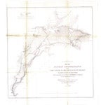
Map of military reconnaissance from Fort Taylor to the Coeur d'Alene Mission, Washington Territory [1862?]

| Origin/Agency/Author: | Mullan, John, 1830-1909 |
|---|---|
| Publisher: | [Washington, D.C.?] : War Dept., Office of Explorations and Surveys |
| Date: | [1862?] |
| Size: | 54 x 54 cm. |
| Condition: | |
| Note: | Shows approximate location of military roads constructed 1859 to 1862. Also shows farms, camps, trails, bridges, vegetation types, rapids, rock outcrops, landings and locations of battles. |
| Location: |
State Library For complete citation |
| View Map: | JPEG |


